Folks,
In my last email I was all revved up about using satellite data and AI to fashion apps for development efforts such as CODEP. Now, let’s talk about how this fits in for Haitians, themselves.
First of all, here’s a wrinkle. The Animators (the leaders of CODEP) are actually quite suspicious of data. Three of them have told me directly that “if a computer says it, we don’t trust it.”
As I dug into their issues, I realized that they place a premium on trusting the source. They will accept information, but only if it is brought to them by people they know and trust. When CODEP folks decided I could be trusted, we were able to move ahead with more complicated projects such as cataloging, measuring, and analyzing tree cover.
Second, Kingzer, whom we introduced to you this spring, is hard at it. He is doing the legwork so that CODEP will be able to do better analysis. Right now he is mapping the zones by dividing them into segments, counting the trees in each, and extrapolating total numbers from there.
Third, drones are playing a real role now. We tried them out about eight years ago but didn’t have the wherewithal to make much out of the pictures and videos. Now CODEP is smarter about using drones to spot open/available patches of land. The drone images are also shaking some long-standing assumptions. For example, CODEP people think it is futile to plant on the north sides of mountains. Yet, drone images show that where the sun is limited, growth might be slower but it is possible. They have shifted the thinking.
Stay tuned!
Michael Anello
Executive Director
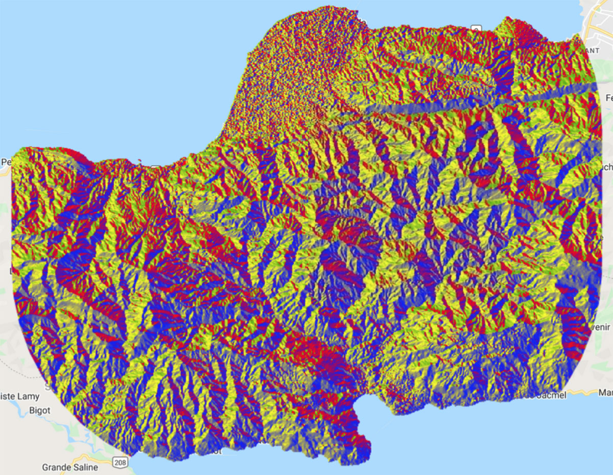
PS: The picture below was developed by the NASA DEVELOP team as they studied the steepness and the direction of the mountain slopes in the CODEP region.